Our new service Sampling Spot navigates you to a representative location on the plot. Normally, ad random samples are taken during the growing season to get a good indication of the yield of a plot. It is often difficult to take a representative sample in the plot.
GEO4A has developed a tool, to indicate locations/areas on a plot that are representative of an average yield. We developed this tool based on Satellite data and in situ data. The Sampling Spot tool has been validated using data from the yield meter on a potato harvester and in cooperation with our customers.
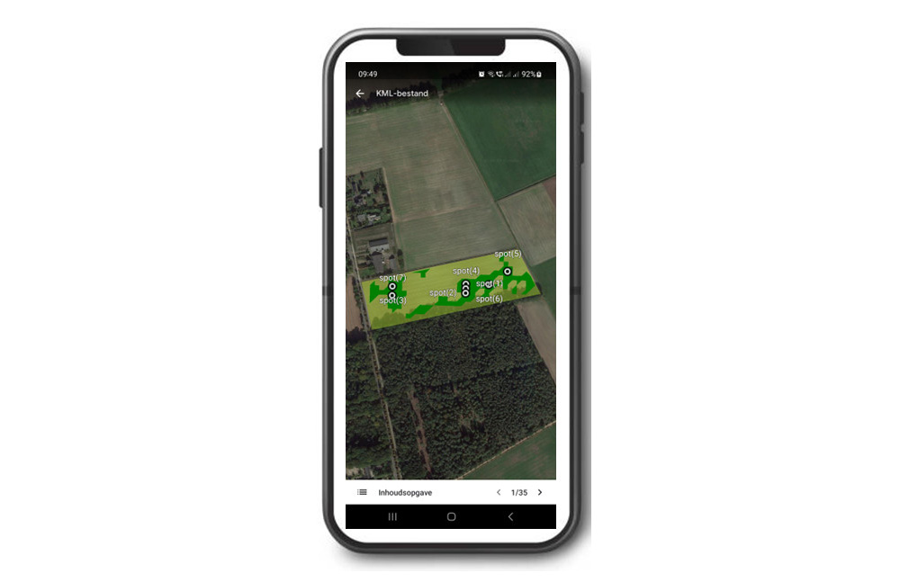
To clearly mark and visualize the sampling locations, a KML (Keyhole Markup Language) file can be read on any Pc, Tablet or Phone. KML is a file format used to display geographic data in an Earth browser such as Google Earth. By using the GPS signal on your device, you are navigated to a relevant location(s). This provides companies with the ability to have anyone within the company perform representative test digs or possibly externally, with proper instructions. If you are interested, please drop us a line.